We went to Bryce Canyon National Park first thing this morning. Our first stop was at the Visitor Center, to get their map and suggestions for hikes. The ranger recommended we first tour the Amphitheater section, which has the most iconic and popular views. He also recommended we park the car at the Visitor Center, and take the free Shuttle, that circles the Amphitheater section and stops at all of the major viewpoints and trailheads. It was a GREAT suggestion and worked really well. You can hop on and off, and it comes every 10 - 15 minutes.
The Amphitheater section was formed (I read this on the plaque, so let's see if I can get it right) when the Colorado Plateau had an upheaval along fault lines, leaving the lower section 2000 feet lower than the higher mountain range. Over millions of years, the area between them started to erode, due to water flowing, and water freezing and expanding in cracks, and other factors. In any case the sandstone rocks eroded into many different colorful formations, including hoodoos, or pillars of rock, spires, pinnacles. finns, and cliffs. From the rim of the Amphitheater, looking down to the canyon floor is 2,500 feet. The rim is at 9,100 feet and the floor is at 6,600 feet.
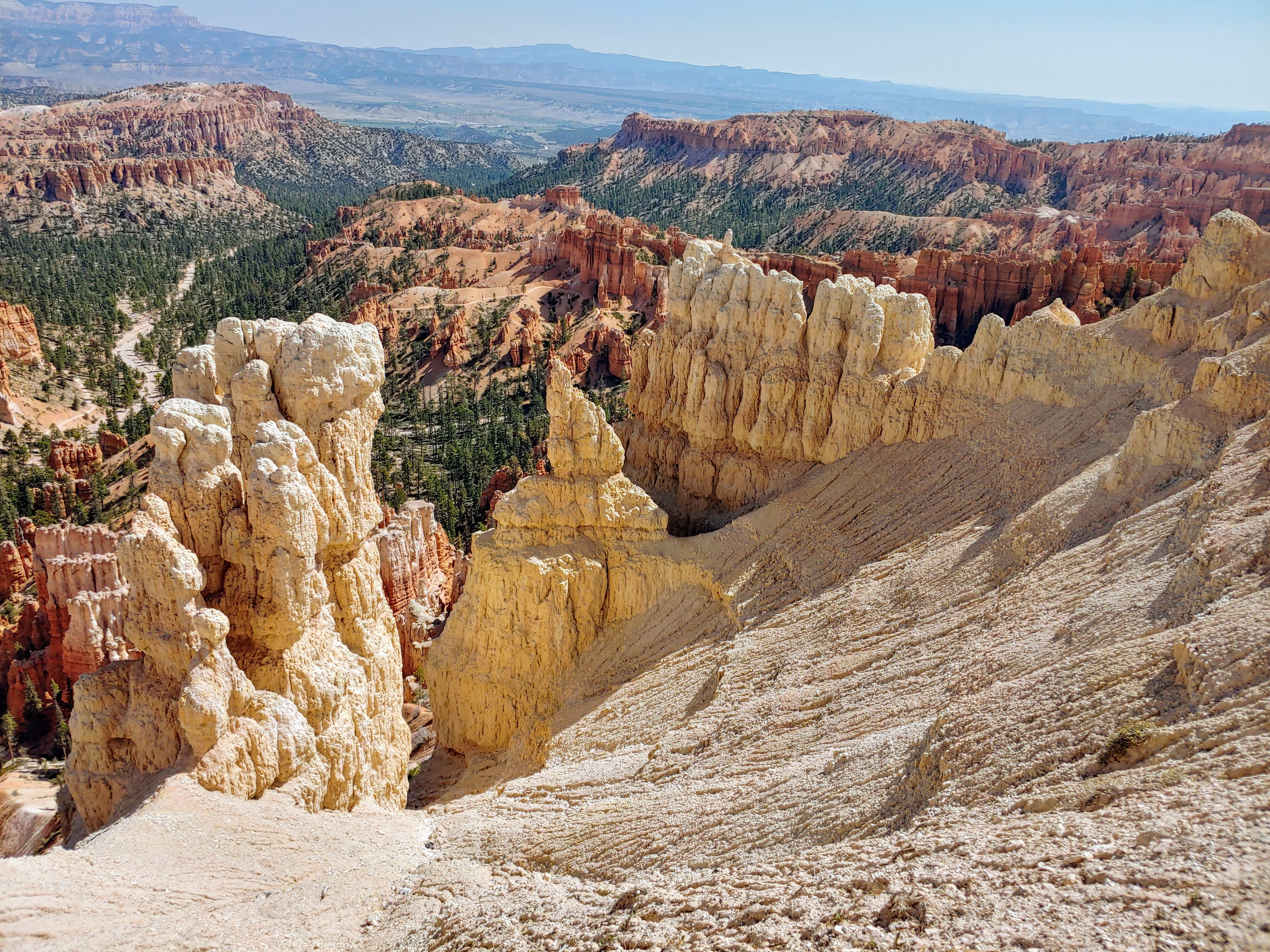
Our first shuttle stop was at Bryce Point overlook. From there, we walked 2 miles on the Rim Trail to Inspiration Point and then on to Sunset and Sunrise Points. In fact, we walked around the rim of this incredible basin, looking thousands of feet down to the basin floor. But, it includes several levels, each one huge and multi-layered, and then it descends some more. But ALL THROUGHOUT the entire Amphitheater was littered with formations -- hoodoos, fins, things that looked like castles built into the rock, spires sticking up in strange shapes, etc. And as you walked around the rim, each formation looked different, depending on the view. But this place is huge--the rim trail goes on for 11 miles. We only walked 2. And the colors were mostly white, and red/orange. This is one of the most AMAZING sites I have seen so far. I couldn't take enough photos, and they don't do it justice.
We ate our picnic lunch overlooking one of the views, then picked up the Shuttle again. The next stop was the Bryce Canyon Lodge. This lodge was built back in the 1920's and has been restored to reflect its rustic style. We had coffee (and Peter had his ice cream). Jumped back on the Shuttle and returned to our car.
The rest of the park is seen along an 18 mile scenic drive, also following the rim. We drive to the southern most point which had the Yovimpa Point and the Rainbow Point overlooks. Short loop trails led to more views from the rim, looking down into the valley bottom, with different formations caused by the eons of erosion. The route back along the scenic trail had several turnouts, each overlooking a different canyon and chasm. The most interesting was the Natural Bridge. It turns out this isn't really a bridge, although it looks like one. A bridge needs to have running water beneath it, and this one doesn't. So, it is an arch. No matter what its called, it was impressive.
What an incredible day of sightseeing. What an incredible National Park. Amazing to visit, but not an environment I'd like to live in.
Right near our campground is the Red Canyon National Forest visitor center. So we stopped in to get a trail map and a sense of what there is to see here, for our hike tomorrow. Got some good maps and recommendation for a hike.
Lots of Bryce Canyon National Park photos:
Amphitheater photos:
Bryce Point overlook photos:


No comments:
Post a Comment