Thursday, October 31, 2019

Oct 28 – To Yosemite National Park, California


  We had a fairly long, winding, slow travel day.  The landscape really changed from steep mountains covered with pines, to less steep mountains, covered with more deciduous and scrub trees, with no underbrush other than the golden grasses.  We did start to see more cattle ranches and some vineyards.  We are definitely out in the middle of NOWHERE.  Even the towns are small.  We arrived at the campgrounds, which are fairly extensive, only to discover that there is no electric, sewer, or water here either.  We had been told by the Thousand Trails main offices that the electric would be turned back on today. 
   After setting up our camp (much easier to do with hooking up anything), we found out that they now do have water and sewer, but still no electric.  That actually works OK for us.  Our black and grey water tanks were the problem, as they were both 2/3’s full when we left the last campground.  We can always run the generator for our electric needs.
  We drove the 5 miles over to the National Park entrance, and got a map.  We drove a few miles in, but decided we have had enough of the climbing, twisty, curvy roads for today.  So we came back to the camp and hooked up the water and sewer.
  We sat out on our camp chairs (even though it was a little chilly), had a beer, and read for a while.
Dinner, then a relaxing evening off the grid.  No cell phones, no internet.  Maybe we’ll even play a few games.

Roadside vistas on the way here photos:


Yosemite RV campground photos:


Sunday, October 27, 2019

Oct 27 - Day off in Lotus, CA

  After our long day in Lake Tahoe yesterday, we decided we needed a day off.  And, since the electricity is off in the entire area around here, most places are closed.  So, we just stayed "home" and boondocked.  We did turn our generator on 3 times -- at breakfast and lunch, for coffee, and at dinner for the microwave.  Otherwise, our batteries were good enough to keep the main light on and one outlet to charge computers, phones, etc.  We did get a little concerned when we first turned on the generator this morning, and we get the message on the display to "check the oil level".  Well, here we go again.  We know NOTHING about the generator--like where the dip stick is, or even how to check it.  No one ever told us we needed to check the oil level in the generator.  We hardly ever use it, so why should it be low?  When one of the maintenance men from the campground drove by in his electric cart, we asked him if he knew about RV generators.  He came over and showed us how to open the generator panel, where the dip stick was, and that the oil level was actually OK.  The online manual says to check the oil level every 100,000 hours of use, or one year, whichever is earlier.  So, it has been a year.  Does that message just automatically appear, or is the oil actually low, and the guy just didn't know how to read the gauge.  If low, we don't have any oil to fill it with, but we do now know where to pour it.  So--get some oil, and learn the proper level on the dip stick.
   Otherwise, it was an easy going day.  The wind was gusting a lot.  We have never been in such high winds, when the weather was sunny and warm.  Only when there were storms.  But, the high winds are why the power company turned off the electricity, to help prevent forest fires.  The high winds blew down tons of brown pine needles.  I am used to 2-3 inch pine needles, but these are 8-10 inch ones. 

Pine needles photos:


Oct 26 - Lake Tahoe, CA

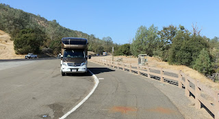
We decided to drive the 1.5 hours up to Lake Tahoe.  It was a beautiful day, sunny, in the upper 60's in Lake Tahoe today, and tomorrow they were supposed to have a high of 38 degrees and cloudy.  It is only 58 miles from our campgrounds, but the last 30 miles was, of course, all curvy and winding, up the mountains.   So the going was slow, with lots of turnouts to let the locals pass, as the actual speed limit was 55 mph.  Yeh, my maximum speed, in the car, not the RV, was 45.
  Anyways, our first stop was at the Emerald Bay State Park.  This is an incredibly beautiful small bay on the south east side of Lake Tahoe.  Unfortunately, since it was such a beautiful day, and a Saturday to boot, the traffic was heavy, and finding parking was difficult.  I did luck out and find a spot along the road.  We walked over to the lookout called Inspiration Point.  It looks out over the lake, the south side of Emerald Bay, and also over the small, only island in the lake.  This lake became a popular vacation area in the late 1800's, early 1900's.  I can't imagine driving the roads getting to the lake, or around the lake back then!  There was one stretch of road that had a 10 mph speed limit, around the switchback, and then went over an isthmus of road, with steep drop offs on both sides.
  We continued up the road on the east side, to Sugar Pine Point State Park, just south of Tahoma.  A wealthy businessman built a beautiful mansion, the Hellman-Ehrman mansion, overlooking the lake, at the turn of the century.  The granddaughter sold it to the State, and it is now part of this State Park.  It has a lovely pier.  You can see how clear and blue the water is.  This lake is 1600 feet deep.  We sat on the pier and just enjoyed the day.  We chatted with some folks, and watched as a couple took engagement photos.
   We turned back toward South Lake Tahoe, and stopped at the north side of Emerald Bay, at a lookout by the road.  We saw the Bay and the lake, from the opposite side than we had from Inspiration Point.  Then, we stopped at a lookout area at Emerald Bay State Park, that had been too full to park at on our way up the road.  This area had a huge rock, that I, of course, had to climb.  And another great view of the lake.
  Our last stop along the road was at Taylor Creek.  Right by the road, there is a trail over a bridge, over the Taylor Creek.  Right now the Kokanee salmon are spawning, so there were hundreds of salmon just hovering in the water by the bridge.  I guess they lay their eggs, and then they die.  Their offspring will make their way next spring out into Lake Tahoe.  We then hiked the loop trail, through the forest, the wetlands, and the meadows.  Then back to the road.  However, on the way, by the stream, we saw a brown bear, just quietly doing his thing.
   We ate dinner at the Sprouts restaurant.  A nice health food restaurant, where I felt right at home.  Peter thought is was OK.
  The ride back to the RV was long, but by the time we got back, I was really getting the swing of all those curves.  Do a right curve, then a left one, then a another right one, then another left one, then slow down to 30 mph, then more rights and lefts, and on and on.  Another great day.

Lake Tahoe photos:


Salmon Spawning photos:


Friday, October 25, 2019

Oct 25 - Travel to waypoint on our way to Yosemite. Lotus, CA

  Our day started off very well.  The trip over to Lotus, CA, in the central part of California, southeast from Lake Shasta, and just a little north east of Sacramento, was 200 miles.  The first 180 miles was all on good, one or two lane (in each direction) highways.  Basically flat.  I was very amazed that the majority of the farm land was in orchards.  Fruit and nut orchards.  Very few vineyards.  Some cows here and there.  But mostly these huge orchards.  Very impressive.
  Then the last 20 miles was up the mountain, with 15 - 35 mph sharp curves.  It takes a lot longer to go 20 miles, when your are going that slow.  And, it takes a lot of my concentration.   
  When we arrived at our Thousand Trails campground, on the South Fork American River, we were told that the power company is shutting down the electric power tomorrow at 2 pm.  We could stay, and basically boondock --no electric, no sewer, no bathrooms.  Apparently, in progressive California, they can't seem to keep their population in electricity --we're told that it is fire conditions, and due to the lawsuit they incurred when their company was responsible for a fire, they are now taking precautions, and shutting down the system.  Throughout a large area.  For probably 3 or 4 days! 
  We are here for 3 nights, then we go on to Yosemite.  After calling them, we found that their power will be shut off, but is due to go back on Monday, the day we arrive there.  So, we decided to stay.  We plan on going up to Lake Tahoe tomorrow, so we won't be here anyways.  May even stay the night.  We'll see.
  After we decided to stay, we needed to fill up on gas, since the gas stations will not be able to pump gas without electricity.  The local station already was shut down, so we drove into Placerville, 10 miles away, up and down (you guessed it) curvy, windy, steep roads. 
  Finally, we got back, set up, and I went for a quick walk of the campgrounds, to the nice river.  It was a very delightful view, with the water rapids going by.  But it was also very dry and brown.  Nice, but I am definitely a green person.  Had a cup of coffee, sitting outside, in the 85 dry degrees.  But, at this point, I had no desire to make dinner, so we walked up to the nearby restaurant.  There were only two that were open, due to the electric issues.  Everyone is talking about the electric shutdown. 

Ponderosa RV Resort campground photos:


Oct 24 - Lake Shasta and the Lake Shasta Caverns, California

    We drove up to Lake Shasta, just 20 minutes up the road.  This is a huge lake created by a dam.  It is about 10 - 15 feet lower than it was in the spring, so the banks are all rock/dirt.  We made a 2 pm cruise/cave tour, and arrived in the area a little early.  So we stopped at the Bailey Cove Recreation area on the way.  Just a nice boat ramp/marina into Lake Shasta.
  To get across the lake from the visitor center, you need to take a 15 minute boat cruise.  Once on the other side, they bus you up 800 feet to the entrance to the Caverns, on a narrow, windy steep drop off road.  The tour of the Caverns was around 1 hour, and included climbing or descending 617 stairs.  After the first 80 or so, and the first large room, they gave you the option of returning to the waiting room and watching the rest of the tour on a video screen.  Peter chose that option.  I continued on.
   The formations in the Caverns were REALLY INCREDIBLE!  The area is all limestone, so there were all kinds of cave formations--stalactites, stalagmites, popcorn, curtains, sparkly, smooth, etc.  We went from room to room with our mouths agape.  It was delightful.  I got lots of neat photos. 
  The tour started at the bottom of the caves and went up to the upper rooms.  Then, we walked back down outside, down many stairs, hugging the mountain side, and overlooking the lake.  Great views. 
   Since it was only 4 pm, and too early for dinner, we stopped on the way back in Redding at the Sundial Bridge at the Turtle Bay Exploration Park.  This is a large park, on both sides of the Sacramento River, that had a botanical gardens, lots of hiking trails, and a pedestrian bridge over the river.  The bridge was designed by Santiago Calatrava , and is a suspended, cable bridge, designed as a huge sundial.  It has a glass floor, the same color as the river.  It is impressive, but for 24 Million dollars, they say the glass can heat up to 150 degrees, and the sundial only works accurately once a year.  Worth it?  
  We then decided to go the the View 202 restaurant, overlooking the Sacramento River, and ate outside.  It was so romantic, just like a date!  We watched the sunset, had a good meal, and drank craft beer.  Very nice day, even if we had to stop at the grocery store on the way back to the RV for a few items.

Lake Shasta  and lots of Lake Shasta Caverns photos:


WWII- LCM 4 landing craft, that they use to haul equipment across the lake.
Sundial Bridge photos:


Romantic dinner photos: