Tuesday, September 28, 2021

Sept 26 - on to Hurricane, Utah and Zion National Park

     Nice day for a sort of short 2 hour drive over to Hurricane, Utah.  We went through more valleys surrounded by mountains, and then up, over and through a mountain pass, that was really beautiful.  We ended up on I-15, an interstate again, versus the Utah roads, which took us right to Hurricane.  Compared to Moab, Hurricane is a big city.  However, it is 20 miles from St. George, which is really the larger town.  

   We set up the RV at the Thousand Trails/KOA, another parking lot, but part of our membership.  We do have a great view of the red mountain range across the valley.  However, right behind us is another high cliff, so the campgrounds has minimal cell coverage and no internet.  Since it was still early, we drove in to St. George, and found a Starbucks to hang out at for a while, working on our computers.  I had both my sibling Zoom call and my family Zoom call during our time there.  So, it worked out well.

   We then found a fairly large grocery store (not like Trader Joes or Whole Foods, but OK).  This was the largest, most versatile grocery store we've been to in a while.  So, we stocked up a bit.  Then, decided to go out for dinner.  Since we are in Mormon country, a lot of the restaurants and stores are closed on Sunday.  We arrived at the Olive Garden at around 7 pm, and was told the wait time would be 30-45 minutes.  We ended up sitting on a bench and reading, as we didn't have the energy to find somewhere else.  Back to the RV, and put all the groceries away.  A full day.

No photos today.

Saturday, September 25, 2021

Sept 25 - Red Canyon National Forest and Mossy Cave & Waterfalls, Panguitch, UT

   The weather is beautiful today.  What a change from the Moab area, where we couldn't be outdoors from 11am to 4pm.  Here it is cool in the mornings and mid-70's throughout the day.  Perfect for hiking.

  First on the agenda, though, was a call to cousin Lois for her birthday.  How sweet to chat for a while and catch up.  HAPPY BIRTHDAY LOIS !  I won't say how many Sept 25th's we have chatted on.  

  We had decided to spend the morning hiking and sightseeing, and the afternoon "resting" before taking off again tomorrow.  So we drove over to the Red Canyon National Forest and walked the Pink Ledges Trail and the Hoodoo Trail, loop trails that meandered along the bottom of the red cliffs and formations.  This is a nice little park, with impressive formations.  It's interesting hiking on this ground, which consists mostly of ground up limestone.  So its sandy, dusty, white, gravely, and slippery in some spots on the inclines.  Their literature had a really good definition of hoodoos: "The mystical and magical appearance of the rocks that make Red Canyon famous, hoodoos are columns, pinnacles or pillars of rock that have variable thickness and a totem pole shaped appearance.  The formation of these hoodoos started nearly 10 million years ago with the relentless agents of weathering and erosion attacking the weaker layers leaving the more resistant layers in place.  These hoodoos are mainly composed of the sedimentary rock known as limestone and get their distinct pink, red and yellow coloration from tiny iron-rich clay particles contained in the rocks."

   Our next stop was at Mossy Cave and Waterfall.  This spot was just a bit past Bryce Canyon National Park, but started at the bottom of the valley, and not at the rim.  This canyon was created by the run off from natural springs flowing down from the cliffs.  A short hike went up to a "grotto", with spring-fed water dripping down into a small stream that fed into the main stream.  It is quite impressive to see running water here in this semi-arid desert.  It reminds me of home.  But, only the area right around the stream is sort-of green, because the rest of the land is still sort of desolate.  It turns out that the Mormons spent 3 years digging an irrigation ditch so this water would flow down to their ranches and town.  It is still part of the water way today.  

Red Canyon National Forest Hike photos:


Mossy Cave Waterfall photos:


Sept 24 - Bryce Canyon National Park, Panguitch, UT

    We went to Bryce Canyon National Park first thing this morning.  Our first stop was at the Visitor Center, to get their map and suggestions for hikes.  The ranger recommended we first tour the Amphitheater section, which has the most iconic and popular views.  He also recommended we park the car at the Visitor Center, and take the free Shuttle, that circles the Amphitheater section and stops at all of the major viewpoints and trailheads.  It was a GREAT suggestion and worked really well.  You can hop on and off, and it comes every 10 - 15 minutes.  

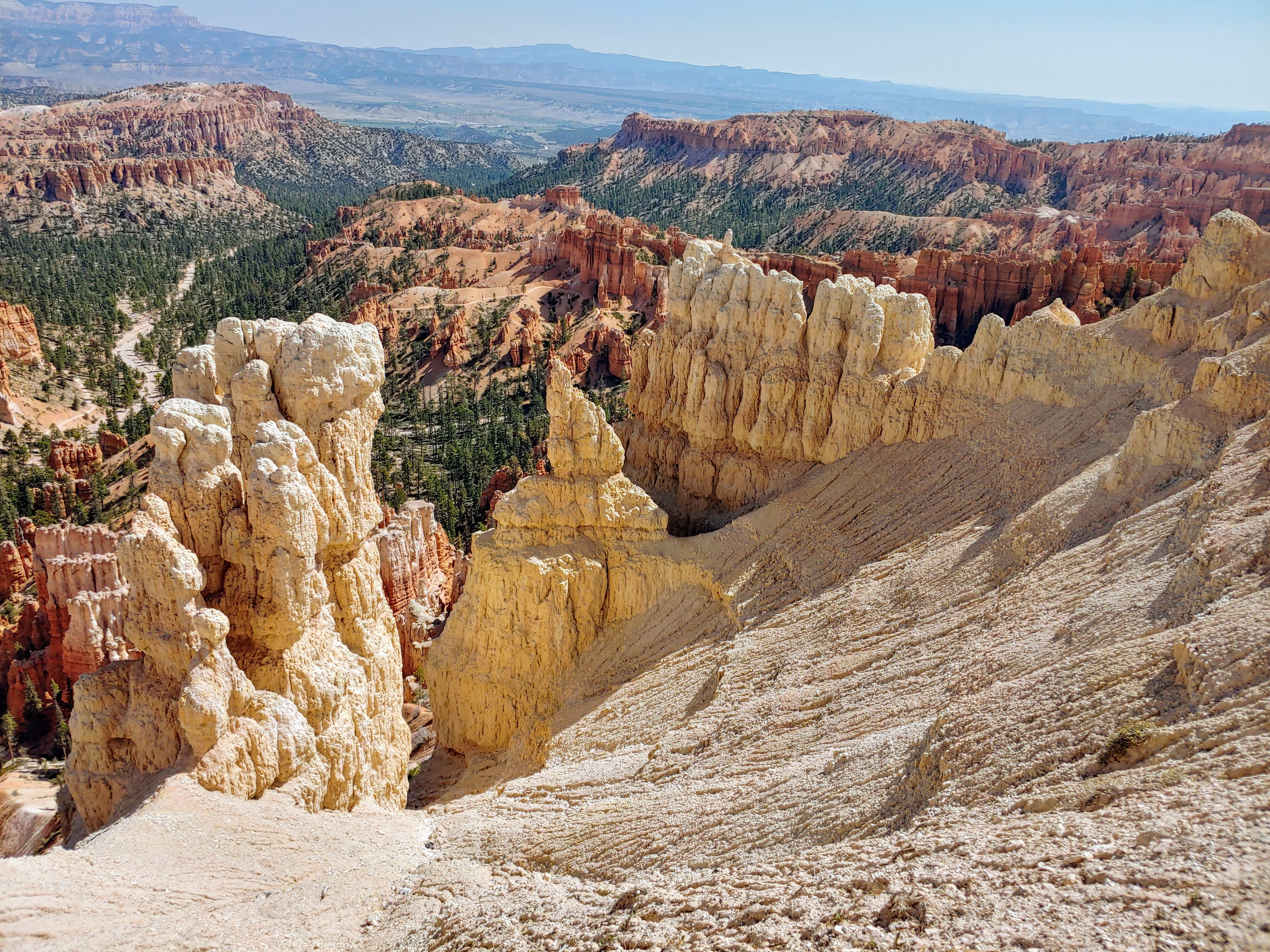
   The Amphitheater section was formed (I read this on the plaque, so let's see if I can get it right) when the Colorado Plateau had an upheaval along fault lines, leaving the lower section 2000 feet lower than the higher mountain range.  Over millions of years, the area between them started to erode, due to water flowing, and water freezing and expanding in cracks, and other factors.  In any case the sandstone rocks eroded into many different colorful formations, including hoodoos, or pillars of rock, spires, pinnacles. finns, and cliffs.  From the rim of the Amphitheater, looking down to the canyon floor is 2,500 feet.  The rim is at 9,100 feet and the floor is at 6,600 feet.  

   Our first shuttle stop was at Bryce Point overlook.  From there, we walked 2 miles on the Rim Trail to Inspiration Point and then on to Sunset and Sunrise Points.  In fact, we walked around the rim of this incredible basin, looking thousands of feet down to the basin floor.  But, it includes several levels, each one huge and multi-layered, and then it descends some more.  But ALL THROUGHOUT the entire Amphitheater was littered with formations -- hoodoos, fins, things that looked like castles built into the rock, spires sticking up in strange shapes, etc.  And as you walked around the rim, each formation looked different, depending on the view.  But this place is huge--the rim trail goes on for 11 miles.  We only walked 2.  And the colors were mostly white, and red/orange.  This is one of the most AMAZING sites I have seen so far.  I couldn't take enough photos, and they don't do it justice.  

   We ate our picnic lunch overlooking one of the views, then picked up the Shuttle again.  The next stop was the Bryce Canyon Lodge.  This lodge was built back in the 1920's and has been restored to reflect its rustic style.  We had coffee (and Peter had his ice cream).  Jumped back on the Shuttle and returned to our car.  

   The rest of the park is seen along an 18 mile scenic drive, also following the rim.  We drive to the southern most point which had the Yovimpa Point and the Rainbow Point overlooks.  Short loop trails led to more views from the rim, looking down into the valley bottom, with different formations caused by the eons of erosion.  The route back along the scenic trail had several turnouts, each overlooking a different canyon and chasm.  The most interesting was the Natural Bridge.  It turns out this isn't really a bridge, although it looks like one.  A bridge needs to have running water beneath it, and this one doesn't.  So, it is an arch.  No matter what its called, it was impressive.  

   What an incredible day of sightseeing.  What an incredible National Park.  Amazing to visit, but not an environment I'd like to live in.

   Right near our campground is the Red Canyon National Forest visitor center.  So we stopped in to get a trail map and a sense of what there is to see here, for our hike tomorrow.  Got some good maps and recommendation for a hike.

   Lots of Bryce Canyon National Park photos:

Amphitheater photos:

Bryce Point overlook photos:


Amphitheater Rim trail photos:


Yovimpa and Rainbow Point overlook photos:


Natural Bridge overlook photo:


Friday, September 24, 2021

Sept 23 - on to Bryce Canyon National Park, Panguitch, UT

    The landscape is changing again.  We drove through several huge valleys, that were prairies, but a bit more green.  Still desolate looking.  Some ran along a stream.  They all had mountain ranges on both sides.  We would pass a SMALL town and there would be NOTHING for 20 -30 miles, no houses, no animals, nothing, and then another small town.  We also went up and over a mountain summit of 11,600 feet.  The area around Panguitch, Utah is more green.  There is even ranching with cattle grazing on green grasses.  I guess we are at around 6,000 feet above sea level here.  Apparently, the Mormons first settled here, on their way up to Salt Lake City.

  We settled in to our RV site. This is definitely an RV parking lot.  But, the site was perfectly level, and is right across the narrow lane from the very clean laundry.  One washer and one dryer, but as no one was using them, I threw in a couple of loads while we ate lunch, and worked on our blogs.  After dinner, we decided to drive in to "town", about 5 miles away, and pick up a few needed items from the local grocery store.  

The road to Panguitch, UT photos:


Thursday, September 23, 2021

Sept 22 - Capitol Reef National Park, Torrey, Utah

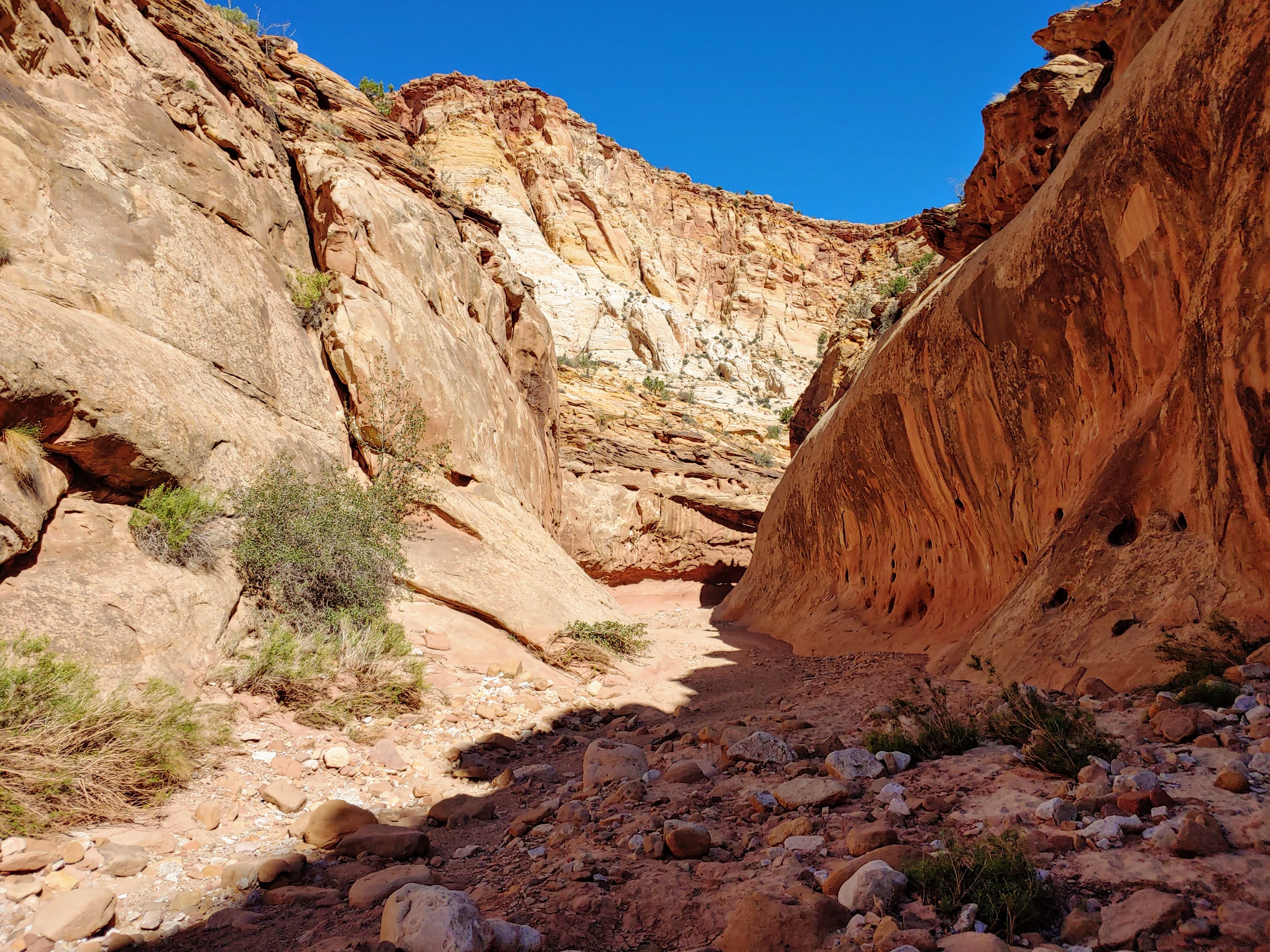
   We left after breakfast for our hike on the Capitol Gorge Trail.  Down the scenic drive through the park to the end of the paved road, then down the gravel road to the trailhead.  Lots of cars, so we needed to squeeze our car into a spot.  This trail is a mile in and a mile back, but you can hike further.  I was surprised to see so many people making the hike, although it is considered 
"easy" as it doesn't have significant climbing involved.  

  The drive in was special, and the hike was spectacular.  Well worth it.  It followed a dry stream bed through the deep canyon.  Along the way, on one of the vertical cliff faces there was what today would be called graffiti.  But, since these were done between 1880 and 1914, they are called "historic inscriptions".  Go figure.  

  We returned to the RV for a late lunch.  I started to catch up further on the blog, Peter on his tax blog.  Since we were "home", I cooked dinner (Stir Fry), and froze some for another day.  After dinner, we walked around the campground, watching the sunset, and ended up chatting with the next door neighbors for a bit.  Nice day.

Capitol Gorge Trail photos:


historic inscriptions


Colorful vista photo:

Sunset view from our campgrounds photo: