Thursday, October 24, 2019

Oct 23 - Leave the coast and travel inland to Redding, CA

  Our road trail went east, from the CA northern coast to Redding, CA.  It was 180 miles, and all of it was through the mountains.  Some of the trip was riding the side of the mountain, and some of it was following the river at the bottom of the canyon or valleys.  All of it was curvy, winding, up and down, and absolutely beautiful.  Great vistas.  It was interesting how few people seem to live on this route.  We passed through a few towns (one had a population of 35).  There were only a few roads leading off from our main one.  It took us 5 hours, since I generally drove only 40 to 45 mph, with a lot of 35 mph turns.  Fortunately, there were many turnouts, and passing lanes.  By the time we got to our next campground, here in Redding, I was ready to stop.
   We set up camp.  This site is nothing to complain about, or to write home about.  It's really just a stop-over on our way to Yosemite.  We are here for just 2 days.  We took a walk around the campgrounds.  There is an unusually uninteresting river that runs along the camp.  The only really interesting thing was the DiscGolf range that is part of this campground.  They rent it out for use to the public.  This is where you throw a Frisbee  down the course, and try to get it into the Frisbee basket.  Since I never saw this before, I questioned a young man coming in to play.  He had at least 20 different colored Frisbees in his pack. Each for a different use, each a slightly different shape, and each a different weight.  Sort of like having a variety of golf clubs.
   The weather went from 58 degrees, on the coast and over the mountains, to 88 degrees here in Redding.  "Although it is a dry heat" everyone says.  And, yes, it is delightful to be without a sweater or jacket, like we have been, along the coast for quite awhile.

Travel across the mountains to Redding photos:


DiscGolf range photos:


Oct 22 - Eureka, CA

  We had an early morning appointment at the Subaru dealer--8:00 am, in the nearby town of Eureka.  Yesterday, up at Lady Bird Johnson Grove, the back tire area was smelling like something was burning, or smoldering.  As it turns out, today it wasn't doing that anymore, and the Subaru dealer tech couldn't find anything wrong.  Better safe than sorry.
   Since we were in Eureka, we went over to Samosa Dunes and Beach.  This is a long peninsula, that has two very long jetties.  In order to get to it, you need to cross over two bridges, that lead to two little islands, and then over to the peninsula.   This Dune area caters a lot to OHVs (Off Highway Vehicles).  The beaches are very sandy and long.  When we got there this morning, it was still all fogged in.  The weather here is so strange.  We went back over into town, maybe 5 miles away, and it was all sunny.  We walked along the beach and along the jetty.  Nice.
  On the way back into town, we stopped at the marina at one of the little islands--Woodley Island. It was sort of cute, lots of  boats, a little lighthouse, and a statue to all of the fisherman lost at sea.
  Later today, Peter read in the paper that yesterday, the State of California returned the other little island, Indian Island, back to the Native Americans that had originally owned it. Apparently, in 1860, the island was illegally sold away from the tribe. Peter feels it is significant that we were there on the very first day it was now owned by the Tribe.
  I needed to do some grocery shopping, and we found this absolutely GREAT Northern Coast Co-Op.  It is the nicest whole foods grocery store I have been in, in a long time.  Way nicer that Whole Foods.  Nice feel, nice folks, good food.  It felt like home.
   Peter sat in the coffee shop there and I went to get my hair trimmed at a salon 2 blocks over.  Then we did the shopping and came back to the RV, and put all the food away.  Sat and drank coffee, and worked on the computer.  Interestingly, it is all overcast here, when it was beautiful sunshine in Eureka.
   We decided to go into the closest town of Trinidad and have dinner.  We found a nice little restaurant right on a cove.

Samosa Beach and Jetty photos:


Woodley Island marina photos:


Pier at Trinidad restaurant on the cove photo:

Tuesday, October 22, 2019

Oct 21 - Patrick's Point State Park and Lady Bird Johnson Grove, California

   Today was a very nice mix of ocean rocky coast and Redwood beauty.  It was a clear blue sky sunny day, in the 60's.  My perfect kind of weather.  First we went across the road from our campground to Patrick's Point State Park.  This park has several overlooks down to the ocean coves, with several major large rocky seastacks, and lots of smaller rock strewn coves, with crashing waves.
  We first went to Palmer's Point overlook.  It had a trail leading down to the "beach", although there was no sand on it.  Only rocks of every size, shape and color.  This area is known for its tide pools at low tide.  The notable thing about this trail is that it is steep, steep, steep and all downhill--leading from the mountain overlook down to the beach.  They had stairs at various spots, and I'm sure there were at least a thousand of them!  My knees thought so.  We got down to the rocky beach and just sat on the bottom steps and enjoyed the cove and it's waves and view.  Then we had to climb back up.  Slow and easy wins the race.  Back at the top, we enjoyed a picnic lunch and the view.
  The next stop was at the Wedding Rock and Patrick's Point Overlook.  Actually, Patrick's Point overlooks the Wedding Rock, but you can view it from two different overlooks.  The Wedding Rock had a really inviting trail, leading down, down, out and then up to the very large Wedding Rock, protruding out into the ocean.  Since we had already hiked down to the beach once, we decided to just enjoy this view.
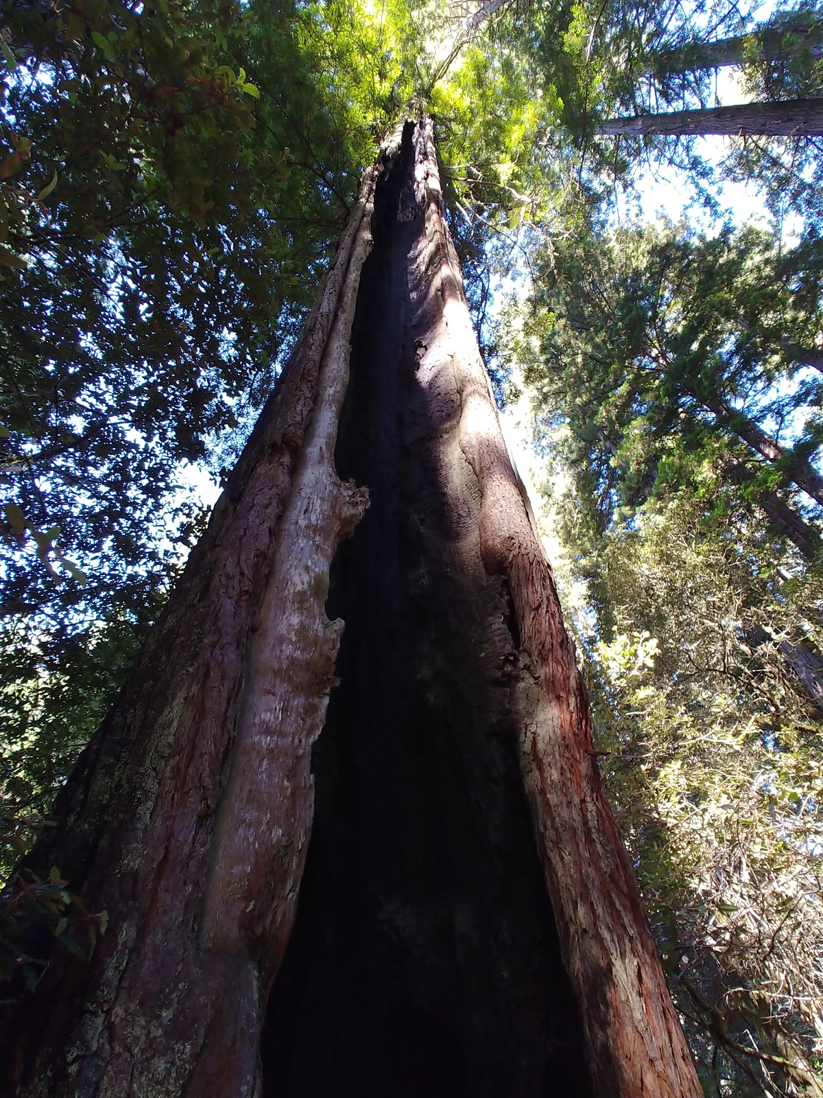
  Our next attraction for the day was about 20 miles north, to the Lady Bird Johnson Redwood Grove.  This was the location that Lady Bird Johnson came to the late 60's to dedicate the Redwood National Park.  It has a delightful 1.5 mile trail through the Old and 2nd Growth Redwood Forest.  Each Redwood Forest that we wander through has its own feel and energy.  This one had many very old trees that had survived various forest fires.  The fires hollowed out the tree on the inside, but the tree still is able to live and thrive.  It's amazing.
   On the way back to the RV, we stopped at the Freshwater Lagoon.  The ocean is crashing onto the sandy beach on one side, and a large freshwater lagoon is on the other side of the road.  I walked the beach for a bit, and then just sat on a tree stump log in the sun and was mesmerized by the very long rows of waves.
  Back at the RV, I vacuumed out the car and the RV, and then enjoyed a cup of coffee, sitting in the sun on our little deck, overlooking the pond.

Patrick's Point State Park photos:


The Wedding Rock


Lady Bird Johnson Redwood Grove photos:


Freshwater Lagoon ocean beach photo:


Sunday, October 20, 2019

Oct 20 - Further south on California Coast

  We had a few challenges today, on our trip down the coast to our next campground.  The biggest issue was the low DEF icon lit up on the RV.  That, in itself, is not a problem, as we have learned to carry a 2.5 gal container of DEF with us.  We even have learned we need to pour it into a funnel, which we now do carry with us, and that we need to BE CAREFUL when pouring it, and that we need to have paper towels at hand to wipe up any spills that do happen.  We have learned all of that in our travels.  However, this time, when Peter put the cap to the DEF on top of one of the engine thingys, it only became a problem when he went to pick it up to put it back on, that it slipped out of his hand and fell into the engine compartment.  You wouldn't think that would be such an issue, however, it fell into the fender, that ended up being a compartment, with a bottom on it.  We struggled to figure out how to find it, and then how to retrieve it.  With Peter under the RV, with a flashlight, he figured out that he could put his arm into the compartment from the side and we finally got it out. 
   Moving on, we arrived at the campground that is in the Patrick's Point State Park.  It is rather small, but our site is situated on a small pond, with a nice deck.  We just took off the rest of the afternoon.  I was able to catch up on my blog posts, as we have good internet here.  And, I had a great weekly family Hangouts call.

Our campsite near Patrick's Point State Park photos:


Oct 19 - Northern CA coast & Redwoods

We spent the day traveling down the California coast for about 20 miles.  This is a very scenic coastline road, and there are many overlooks, incredible ocean beach & jutting rock vistas, with steep, curvy roads leading to them.  The vistas overlook the amazing ocean, each view different and magical, with the waves exploding against the rocks.  How delightful.  We took  a picnic lunch, and had it at Crescent Beach Overlook.  Here is our list of the places we stopped, more or less:

  • Enderts Beach Road, leading to Crescent Beach Overlook--I learned that all those rocks jutting out of the ocean are properly called "seastacks".
  • Requa Rd to the Klamath River Overlook -this took us to the north side of the mouth of the Klamath River
  • Coastal Drive Loop -  This ended up on the south side of the Klamath River.  This started at the Old Douglas Memorial Bridge Site, where an old bridge crossed the Klamath River, but in the 60's a storm destroyed it. It now has one side of the bridge end, with stone statues of bears on either side.  I said "who builds bridges and puts statues on the ends?"  However, on our return journey, we crossed over the new bridge that replaced it, and it has gold bear statues on the ends.  Part of this loop is so narrow and curvy, along the ocean mountain side, that it needed to be one way.  But, way beautiful.
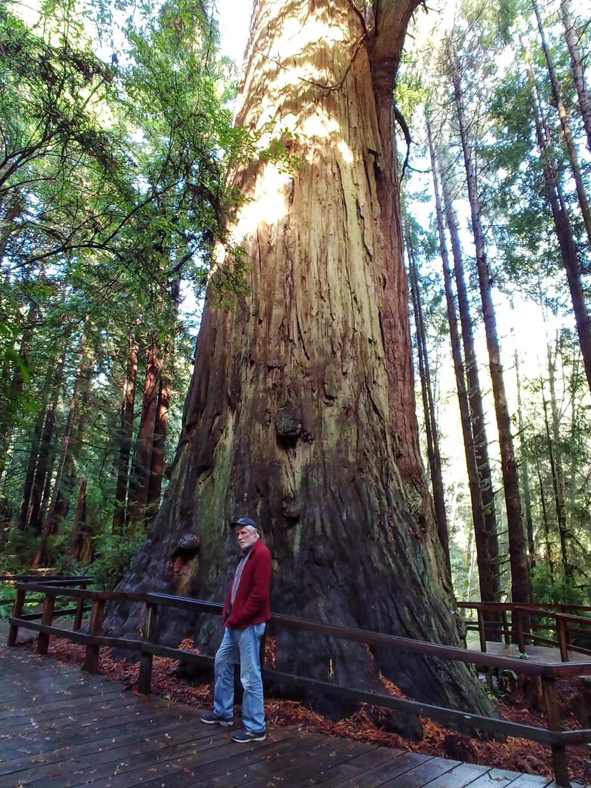
  • Trees of Mystery -- this is a nicely done, private Redwoods forest and walk.  It has one of the tallest, oldest, privately owned Redwood trees in the world.  The trails through the forest were well done, and very informative.  AND, they put in a SkyTram, going 1/3 mile up the forested mountains.  What incredible views from the Tram windows.  I am amazed at how they build these things, perched on the edge of the mountains like that.  They are currently building a tree-top walkway--see photo.  Looks really cool, but scary.
We stopped at the Crescent City harbor for dinner.  There were seals in the harbor on the rocks, barking non-stop.  

California northern Coastal Overlooks and scenic drive photos:


Tree of Mystery Redwood photos: